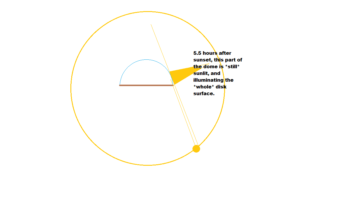
I'll assume a hemispherical (or nearly so) dome, as it's the easiest for me to imagine, as well as providing room for air currents to have more effect than a flatter dome would.
In general, a flatter dome would produce more stagnant weather patterns. Since hot air can't rise as much, convection drops, and with it circulation. You end up with things just getting hotter, and muggier from evaporation from oceans, as the day goes on. And then reversing with nightfall, cooler tempuratures, and moisture condensing out of the air, most likely as fog/dew/etc. rather than clouds, since there's not as much room for dewpoint variation with altitude.
But in a more hemispherical dome, there's room for hot air to rise, warm air to move in laterally to replace it, and cool air to descend to replace the warm air.
Air over land masses generally heats faster than air over water. So the most prominent daytime winds will almost certainly be blowing inland from the sea, as the air above the land is heated, causing it to rise, and the warm air from above the sea moves in to replace it. This will likely be slightly exaggerated in equatorial equivalent regions, where the sun hits most directly, and lessened in polar equivalent regions with less direct sunlight.
As the air moves in from the sea, it will bring moisture with it. As it's heated, it will rise and start to cool as it moves farther away from the land. It is also likely be deflected upwards by the mountains in the middle of the continent. As it cools, this will cause the moisture in the air to condense in to clouds, and possibly precipitate rain or snow. If there are other outlier mountains, separate from the main set in the center, those would cause clouds and rain before the moist air reaches the central mountains, but only in the areas where mountains are in the path of the moist air (see rain shadow).
Unless there is a (mostly) complete secondary ring of mountains outside the main range in the center, a good portion of the moist air will reach the central mountains before losing most of its moisture. This will give plenty of opportunity for rain/snow on that central range.
Here's where things will get complicated. I originally assumed that since most of your question seemed to be leading toward an Earth-like environment, that you intended these mountains to be snow covered. And to accomplish this, the inner surface of the dome would have to absorb heat from the air that reaches it, at a rate that is in an approximation of Earth's atmosphere bleeding heat in to space, making upper climes colder. However, if the entire inner surface of the dome accomplishes this, then oceans in contact with the dome would freeze over, and the air inside the dome would be colder the farther from the central mountains you get, even at lower altitudes, which is decidedly NOT Earthlike. The hot air that rises near the center of the continent and dome would reach the top of the dome and start to cool off, and start trying to sink. It would not be able to sink down through the hotter updraft, so it would spread out sideways in all directions, keeping it in close contact with the inner surface of the dome, accelerating the cooling process (whereas on Earth, air would generally start to heat again as it descended). This would cause it to fall even faster, etc. Until it contacted the ocean, at which point it would be pulled back toward the center of the continent, to replace the air blowing in from the sea and rising over the land. The repeated cycle would continue to accelerate as the day goes on, until hurricane force winds blow in from the sea, with the air being quite frigid, having been barely warmed by the sea before making landfall.
If, however, the dome doesn't suck heat out at the same rate along its entire surface (say, the lower area is heated by the same cosmic entity that's providing gravity), the cycle would be much gentler and more Earthlike.
At night, the entire process reverses, since land cools more quickly than sea, and early in the night the sea will be warmer than the land, and air above the sea will start rising up the inner surface of the dome, which pushes it toward the center, and then will start descending once cooled. The downdraft will be focused primarily over the central mountains, but it's unlikely that the moisture will stay in the air long enough to precipitate over the central mountains themselves. More likely there will be a ring of coastal rainfall before the air climbs higher. When the downdraft hits the central mountains, they will deflect it outwards. The air above the main land of the continent will also be drawn outwards to replace the air rising above the sea, and the wind direction will change to be primarily blowing from the mountains to the sea. Unlike the daytime, this would be more pronounced over the already cooler polar equivalent regions of land, and lessened in the equatorial equivalent areas.

