4
$\begingroup$

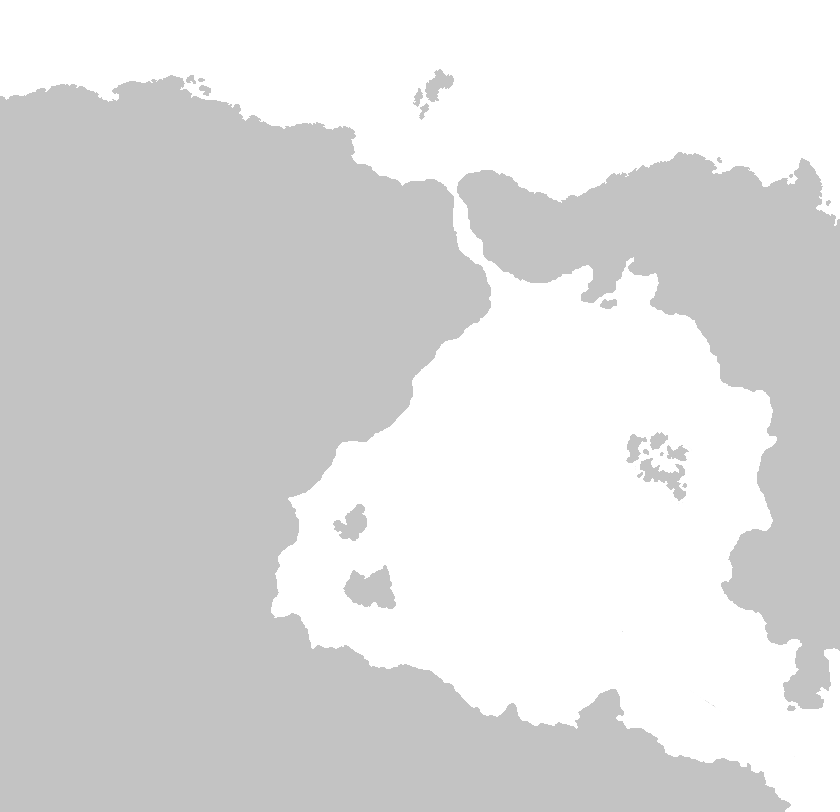
Redoing an old map from scratch, want to get any problems with the coastline/placement/scaling of the land before I get to work on it. I am looking to make it as believable as possible.

Here is the current map with some notes added on:
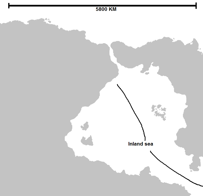
This is the old one for reference with a rough sketch of tectonic plate placement added on:
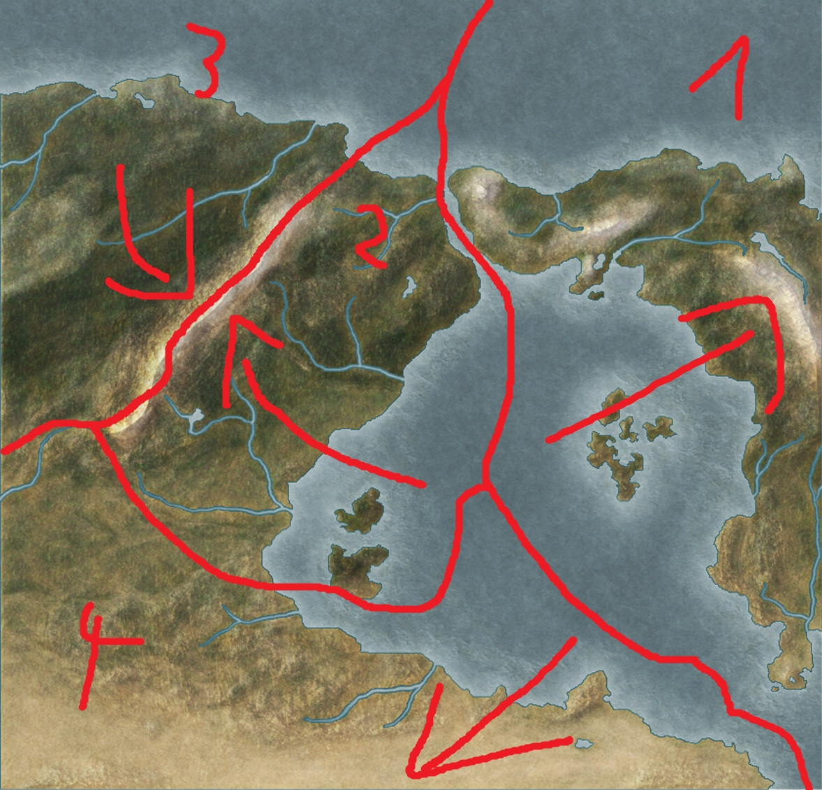
Any feedback would be appreciated.

EDIT:

Updated map:enter image description here

$\endgroup$
3
  • 1
    $\begingroup$ Welcome to Worldbuilding.SE! When you have a moment, please take our tour and visit our help center. Stack Exchange is not a discussion forum. They are Q&A sites where specific questions receive specific answers. Asking for general commentary is off-topic. Do you have a specific question about your map that leads you to believe it might not be believable? $\endgroup$
    – JBH
    Commented Jul 14, 2018 at 22:32
  • $\begingroup$ Like maybe about that funky outlet into the ocean, or the mountains on the plate east of it? $\endgroup$
    – Willk
    Commented Jul 14, 2018 at 22:53
  • $\begingroup$ good map +1 for detail, can i ask what your using the map for (a book, game ect) just interested. also if you want send a message to some one just use the @ then there name like so @Netscapdov $\endgroup$ Commented Jul 15, 2018 at 3:43

2 Answers 2

9
$\begingroup$

There should probably be an island chain extending north around the borders between plates 1, 2, and 3, perhaps a inlet around the border between 2 and 4, and a continuation of the western mountain range westward along the 3/4 border.

Other than that, maybe make the inland sea shallower except along plate borders, and maybe turn the eastern archipelago into a larger arc with some other islands to the NE (similar to the Greek Islands).

The coastline itself looks pretty good though.

Edit: But maybe shrink the size of the map (in km) by a factor of about 25%. 5800 km is a bit too large for a Mediterranean-esque sea

$\endgroup$
10
  • $\begingroup$ I think the distances would still be a bit too big to further extend the archipelago. That aside I agree with your other suggestions and will implement them in, thanks! $\endgroup$
    – Netscapdov
    Commented Jul 15, 2018 at 0:26
  • $\begingroup$ Thank! Also what sorta latitude is the region at? Essentially the same as Europe? $\endgroup$
    – majestas32
    Commented Jul 15, 2018 at 0:27
  • $\begingroup$ Something like that. Thought of it as the tip of the Southern peninsula being at a comparable latitude with Mauritania/Western Sahara. $\endgroup$
    – Netscapdov
    Commented Jul 15, 2018 at 0:38
  • $\begingroup$ Just to clarify this is referring to the peninsula at the very bottom of the map not the one on the Eastern landmass. $\endgroup$
    – Netscapdov
    Commented Jul 15, 2018 at 0:54
  • $\begingroup$ Small suggestion not worth its own answer: Between plates 2 and 4, just south of the mountain range, you have a divergent boundary on land, which should create a rift valley. $\endgroup$
    – Ryan_L
    Commented Jul 15, 2018 at 4:23
-1
$\begingroup$

The angle of the 2-4 boundary creates some issues to my way of thinking about tectonic movement. The area near the 1-4 boundary will be a subduction centre causing an Andes style mountain range, after the boundary turns the corner to trend north-west south-east it becomes a rifting zone, it's not impossible, just a bit odd looking, also the mountain range at the 2-3 boundary should continue along the 3-4 boundary as a transform fault range, similar to the Southern Alps and/or the Sierra Navada range.

$\endgroup$

You must log in to answer this question.

Not the answer you're looking for? Browse other questions tagged .