6
$\begingroup$

For a while I've been making a realistic planet that is quite similar to Earth. I've finished the tectonic plates, ocean currents, wind patterns, and a rough height map. Next up is the biome map, which I've made following the Köppen climate classification system, and Artifexian's guidelines, as well as all of his previous videos leading up to that point. I want to know if this map is accurate or if there are any criticisms I should take into account.

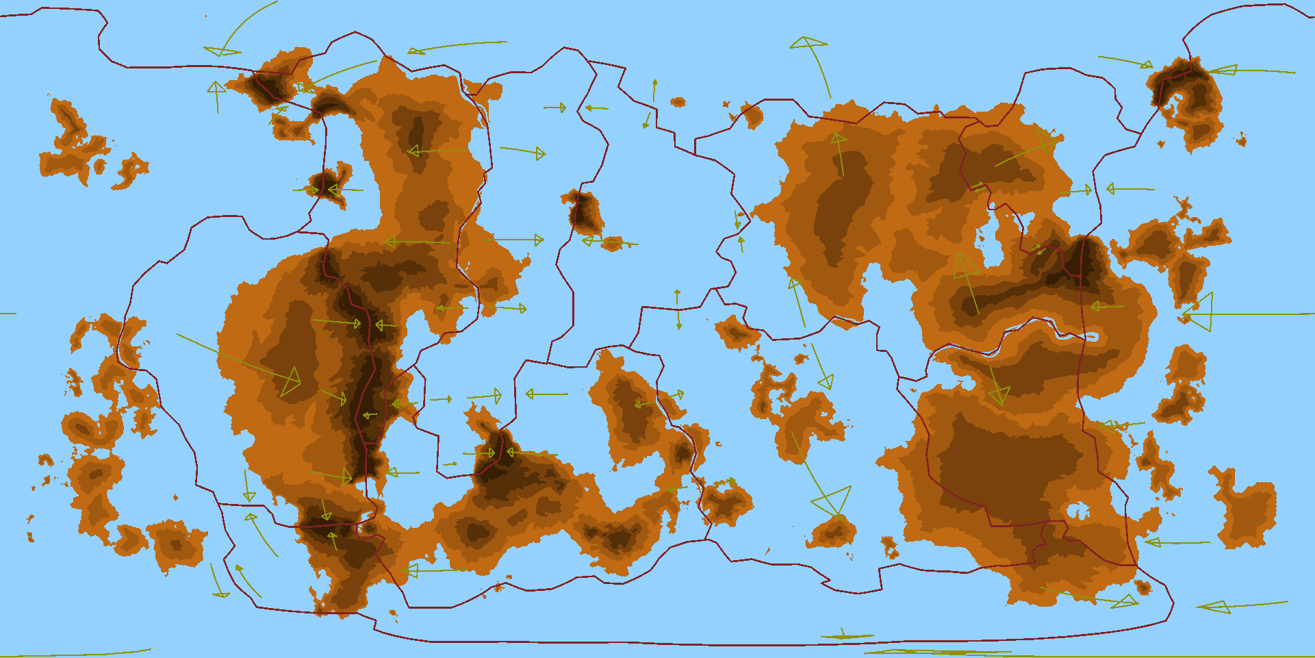
This is a rough height map with included tectonic plate overlay. From lightest to darkest, heights range from 0-99 meters, 100-299 meters, 300-499 meters, 500-799 meters, and 800+ meters. Rough height map with included tectonic plate overlay.
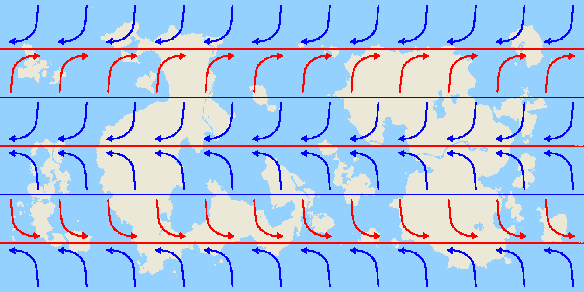
These are the wind patterns, which are very similar to Earth's. Standard wind patterns, very similar to Earth's.
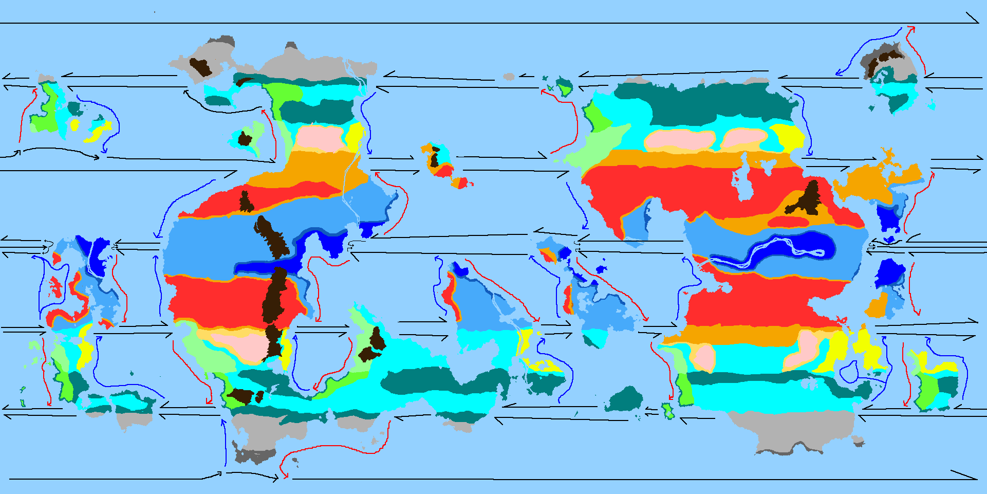
This is the biomes map that I want to know is accurate or not. It includes a map of the finished ocean currents, as well. Biomes map with finished ocean currents.
$\endgroup$
4
  • 2
    $\begingroup$ What is each color supposed to mean in the last map? $\endgroup$
    – L.Dutch
    Commented Jan 6, 2022 at 4:34
  • 2
    $\begingroup$ They represent the Köppen climate classification system, as detailed in Artifexian's climate videos. I apologize for the confusing color system, but I decided to follow the video as closely as possible to limit error. $\endgroup$
    – Foil
    Commented Jan 6, 2022 at 7:23
  • $\begingroup$ This is my wheelhouse and even I don't have a copy of the Köppen climate classification either to hand or memorised so I've added a link. $\endgroup$
    – Ash
    Commented Jan 6, 2022 at 7:52
  • $\begingroup$ Looks great at a glance! What tools did you use to make this?? $\endgroup$
    – Stivsko
    Commented Jan 6, 2022 at 10:42

1 Answer 1

4
$\begingroup$

You've included current effected coastal deserts which most people forget are a thing so well done. You appear however to have neglected the effects of orographic rainfall and rain shadow around you mountains; this will some quite serious and expansive effects, especially on the larger western continent with it's high convergent mountains. Otherwise it looks quite good with the possibly exception that the smaller landmasses may have more of a maritime climate than you have given some of them credit for.

$\endgroup$
1
  • $\begingroup$ I would have posted the same thing. The horizontal banding pattern seems too regular - even if there are bands like that at the boundary of the Sahara, for example. The Seahorse's Saddle, given its apparent prominence, should have wetter areas where the winds move uphill on their way toward it, and drier areas in the lees. $\endgroup$ Commented Jan 6, 2022 at 21:16

You must log in to answer this question.

Not the answer you're looking for? Browse other questions tagged .