My suggested workflow. Blender-Gimp combo for planet building.

In Blender:
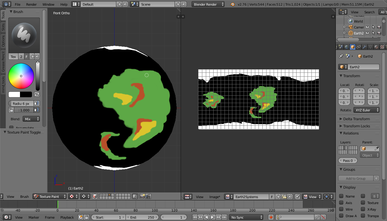
Use Blender to add an UVSphere, tune the resolution at will but I do not recommend to use a high poly sphere.
UV Unwrap the sphere using one of the built-in algorithms. Follow this video tutorial for a better unwrapping: https://www.youtube.com/watch?v=colJyjvf5jw
I would use Sphere Projection rather than the one used in the video. Cylinder may work too. The difference is that Cylinder will stretch the quads toward the poles while Sphere will try to make them all same size. Usually textures created from real photos of the surfaces of real planets on our solar system are already stretched towards the poles, so you need Sphere projection to correctly map one of those over a UV Sphere. Cylinder projection is useful when you already have a map created completely in 2D, and with no sense of projection, and now you want to map it to a UV Sphere. In all cases the solitary vertex at the poles will mess the unwrapping, what matters most of the video I linked is that It shows how to handle that vertex.
Also Sphere Projection won't produce a UV Map aligned with the borders of the image but there is a trick to quickly correct It. Create a temporary square texture (1024x1024), do the unwrap using Sphere Projection, this creates a nearly square UV Map but a bit displaced to the right, in the UV/Image Editor area select all vertices then press N, and in the location fields, manually input 512 (1024/2) in the X coordinate field. This will produce a perfectly aligned UV Map. Now switch to the rectangular texture, the UV Map will scale horizontally to cover all the rectangle. As textures tile, not correct the X position won't really produce a wrong result, It's just counterintuitive to work with a displaced UV Map.
Enter Texture Paint Mode. Create a new material in the left panel of type Diffuse, name it after your planet. I like to use 2048x1024 of resolution with no alpha channel. You can use alpha if you need to combine layers later.
Paint your continents using colors to represent ecosystems or heights (not both at the same time, each must be a different texture). I always start with ecosystems: light green is grassland, dark green is forest, maroon are mountain ranges, yellow is desert and so on.
Export the texture as PNG file. Blender also let you export the UV map as a PNG with transparency.
In GIMP:
Import in GIMP.
Use GIMP tools to tune the borders of the continent as you have far more control in GIMP to work at the pixel level. You can add noise by using one of GIMP filters.
Clone the image and now paint the heights (in GIMP not in Blender). You can import the image with the heights in Blender later to see how it looks in the 3D sphere.
Why I use Blender and not GIMP directly? If you start with a rectangle in GIMP you have no sense of projection (planets aren't rectangles but maps are), you draw a continent but when you map it over an sphere it does not look as you imagined it. In Blender you do not have enough control to work at the pixel level (in 3D view, you have a bit more control in UV editor but GIMP is still better) but you have a good sense of 3D, so the continents will look as you imagined them from the very beginning. When you finished to roughly shape the continents, you go to GIMP and correct the borders to add more fine details.
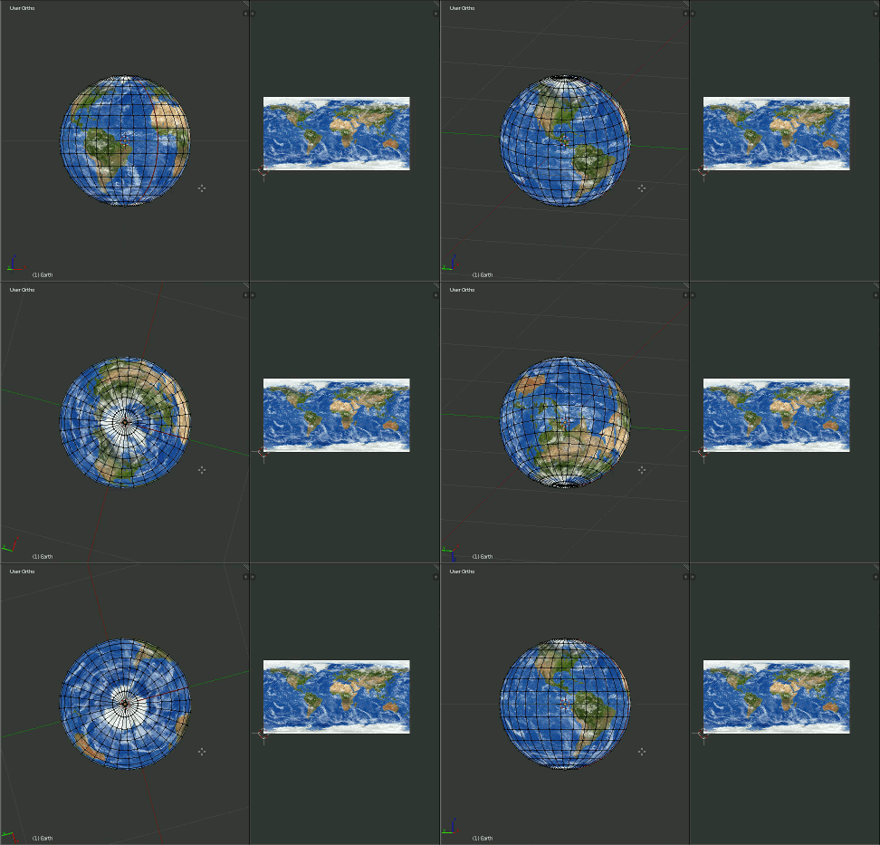
Now, to demonstrate that this method of unwrapping the UV/Sphere works, I loaded a planet Earth texture in place of the fantasy world texture, the result can be compared with real photos to check accuracy of the mapping:

The texture license is CC BY 3.0, and was found here: http://www.solarsystemscope.com/nexus/textures/planet_textures/
Cities (This is more an idea with potential than a working and tested workflow):
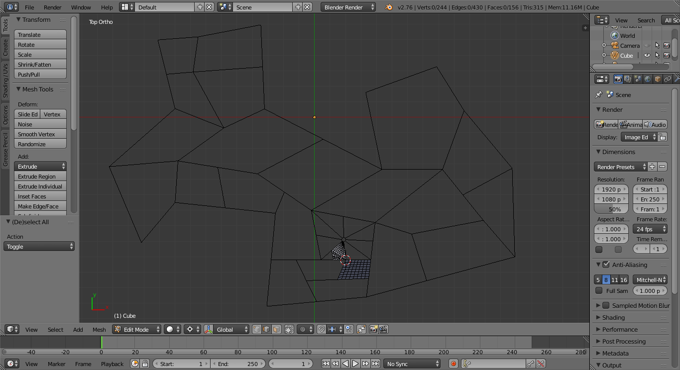
You can use Blender to trace the principal avenues and streets of your city. Then the idea is to use some kind of algorithm to automatic trace less important streets and place buildings. Important buildings (where the action takes place) need to be modeled by artist, but background buildings can be generated by a program. The problem here is that I didn't find such program yet nor was I successful into creating my own algorithm.
You can continue adding streets until you do all the city by yourself but that sound like a lot of work and It doesn't sound viable to me. So an algorithm to generate buildings and streets is needed. I studied some papers describing a set of techniques but some escape my current skills and others do not adapt to my needs.
Anyway I at least can initiate you in this subject.

You can use vector graphics for the street map, for example InkScape, but I find Blender better to do streets maps.
Some tools that may be of interest to you:


