I've recently decided to revive an old project of mine involving an alien planet. Unfortunately, however, I was not as good a worldbuilder then as I am now, and that's having some consequences.
Back when I started it, I drew up a map of the planet - giving only minor consideration to plate tectonics, with otherwise no scientific preparations.
I want to keep the map, so now I have to go through the agonizing process of constructing a world, starting from a map.
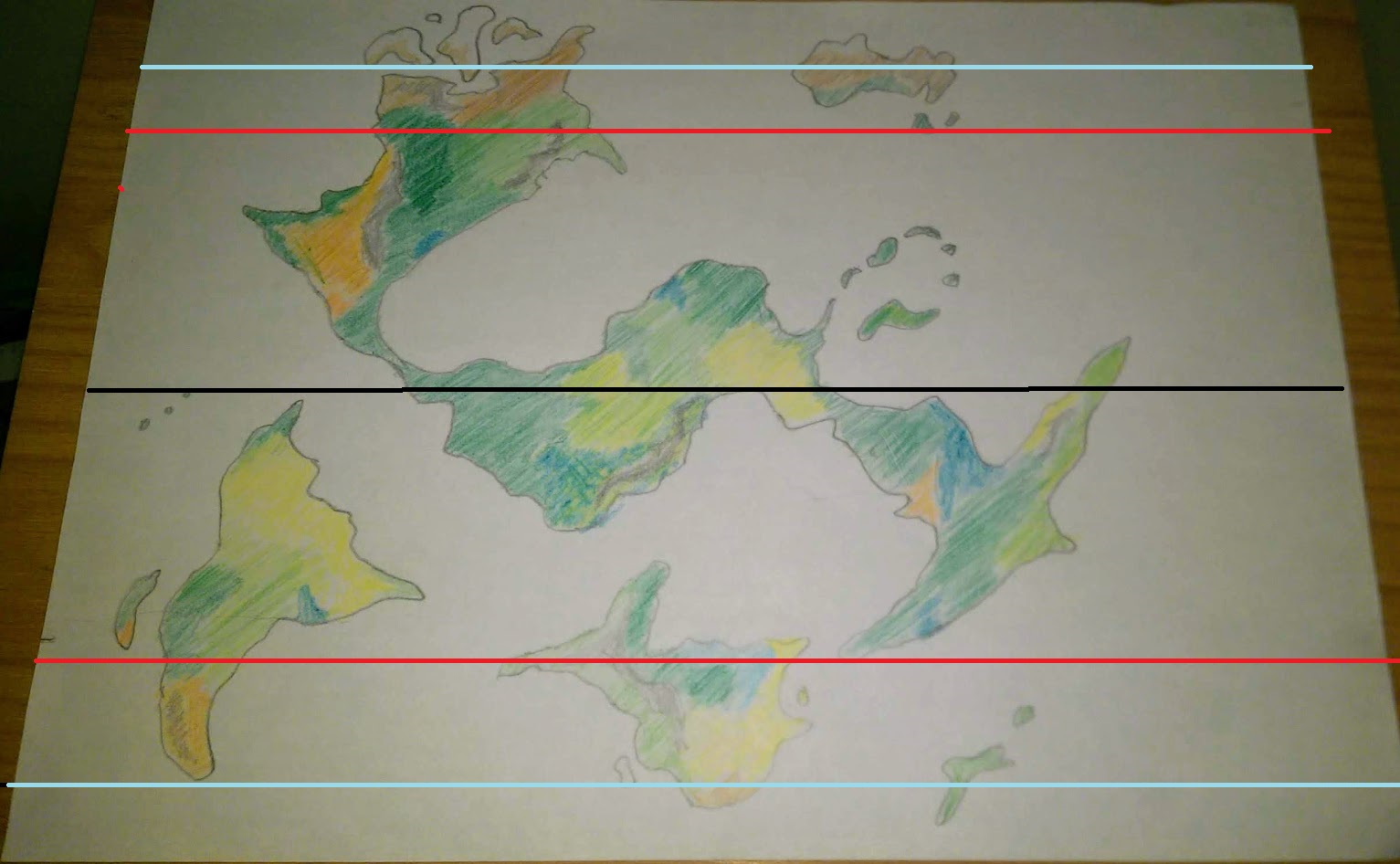
Here is the map of the planet:
The black line is the approximate equator. Everything between the red lines has a tropical climate, BUT these are not the tropics. Everything outside the blue lines experiences temperatures equivalent to the Arctic and Antarctic circles of earth, BUT these are not the polar circles.
So, my question is: Taking axial tilt, ocean currents and prevailing winds into consideration, how can I justify the climate distribution of my planet? A high axial tilt would mean large tropical regions, but with the consequence of extreme seasons, preventing tropical climate within those areas.
If you require further details on the planet, believe this question is flawed or need anything else, please let me know and I will respond accordingly.

