2
$\begingroup$

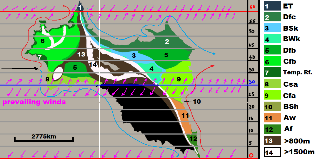
The continent is located on the Earth-like planet.

The first map depicts a rough Köppen classification (which is there to give you bit of a context).

Note that:

  1. Types 13 and 14 are undefined/placeholders, only marking the altitude.
  2. Edit: The coast of the area in question (painted black) is subjected to El Niño–Southern Oscillation.
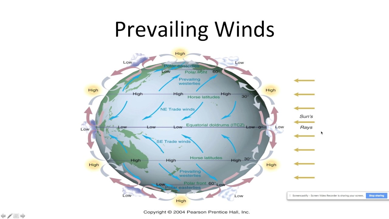
  3. Marked prevailing winds function the same way Earth's winds do. (Compare to map no. 4)

The area in question is the south-eastern chunk of land, painted in black.

enter image description here

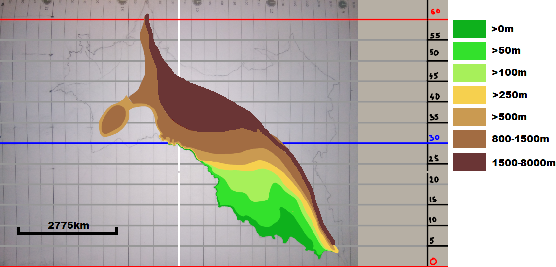
The next one is an altitude map, which is fairly obvious.

enter image description here

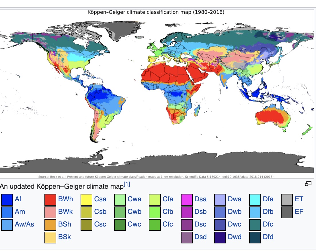
The Earth's Köppen classificaiton map, for comparison. Note that I used different colouring.

koeppen scheme

https://en.wikipedia.org/wiki/Köppen_climate_classification#/media/File:Köppen-Geiger_Climate_Classification_Map.png

enter image description here

Thanks in advance.


Edit:

Marked the prevailing winds on the first map.

Restructured the question a bit, added the map of Earth's prevailing winds.

Added sources:

$\endgroup$
2
  • 2
    $\begingroup$ Video was long! I added key for Koeppen system from wikipedia $\endgroup$
    – Willk
    Commented May 17, 2020 at 0:21
  • $\begingroup$ It was just one of many in the series. I will post links as sources, if need be. Anyway, thanks. $\endgroup$
    – scipio
    Commented May 17, 2020 at 2:21

1 Answer 1

1
$\begingroup$

It will be wet.

3 and 4 above your mountains. are BSK and BWK, which are semi-arid and desert. I conclude they are in the rain shadow of the mountains which means the prevailing winds are from the south. So these winds have dropped their moisture on the other side of the mountains, which is the area you are interested in.

You could make your flat plain be oceanic (Cfb) on the coast, grading into humid subtropical (CFa) and then rainforest (Af) as the altitude increases and clouds drop their rain. Maybe a band of CWC subtropical highland before your altitude gets really high.


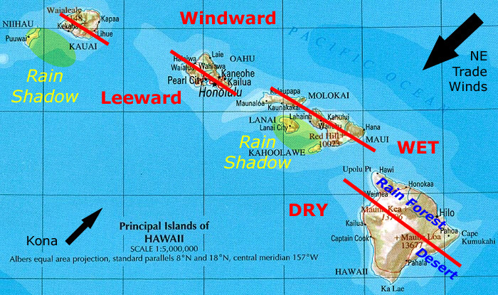
As regards prevailing wind, I think of islands like Hawaii. Maybe your island is more of a continent. Check out the one big arrow for the prevailing trade winds; Kona wind is a lesser and occasional wind. The high altitude in the middle of these islands combined with the moisture laden trade winds means there is a wet side and a dry side of each island.

http://www.sandwichislands.com/Graphics/rainfall.jpg

enter image description here

$\endgroup$
2
  • $\begingroup$ I've added prevailing winds to the map, to avoid confusion. Please check to see if your conclusion about the winds matches the new info. $\endgroup$
    – scipio
    Commented May 17, 2020 at 3:30
  • 1
    $\begingroup$ Maybe I have not looked at enough maps of prevailing winds. Your arrows look like they pointing right at each other! When I think of an island and prevailing winds I think of arrows going the same direction. Something like this: sandwichislands.com/Graphics/rainfall.jpg. Some maps, in addition to the trade winds (single big black arrow here) include more minor and occasional winds. $\endgroup$
    – Willk
    Commented May 17, 2020 at 12:46

You must log in to answer this question.

Not the answer you're looking for? Browse other questions tagged .