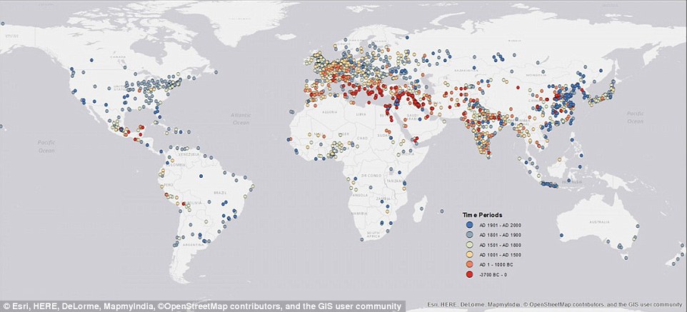
I am creating a map for a story set in a pre-industrial world, and have made the basic physical geography. My main concern now is the development of culture, centred around urbanisation. There are some obvious commonalities between major cities historically; mostly that they are along a river or beside the coast, and are otherwise accessible to surrounding regions in order to become trade hubs.
I'm going to assume that cities develop like rivers; and the largest ones are fed by tributaries. People and water flow along the path of least resistance between physical boundaries, and so the size and influence of a city is dependent on its catchment area. I'm also going to assume that cities first developed and then spread from continental cradles of civilisation (like the fertile crescent), and that these cradles had specific qualities.
I'd like some geography and science to support (or refute) these notions. Is there any analysis (the more sources the better) which can be summarised/cited to explain where and why ancient cities first developed and spread, also how this development is relational?


