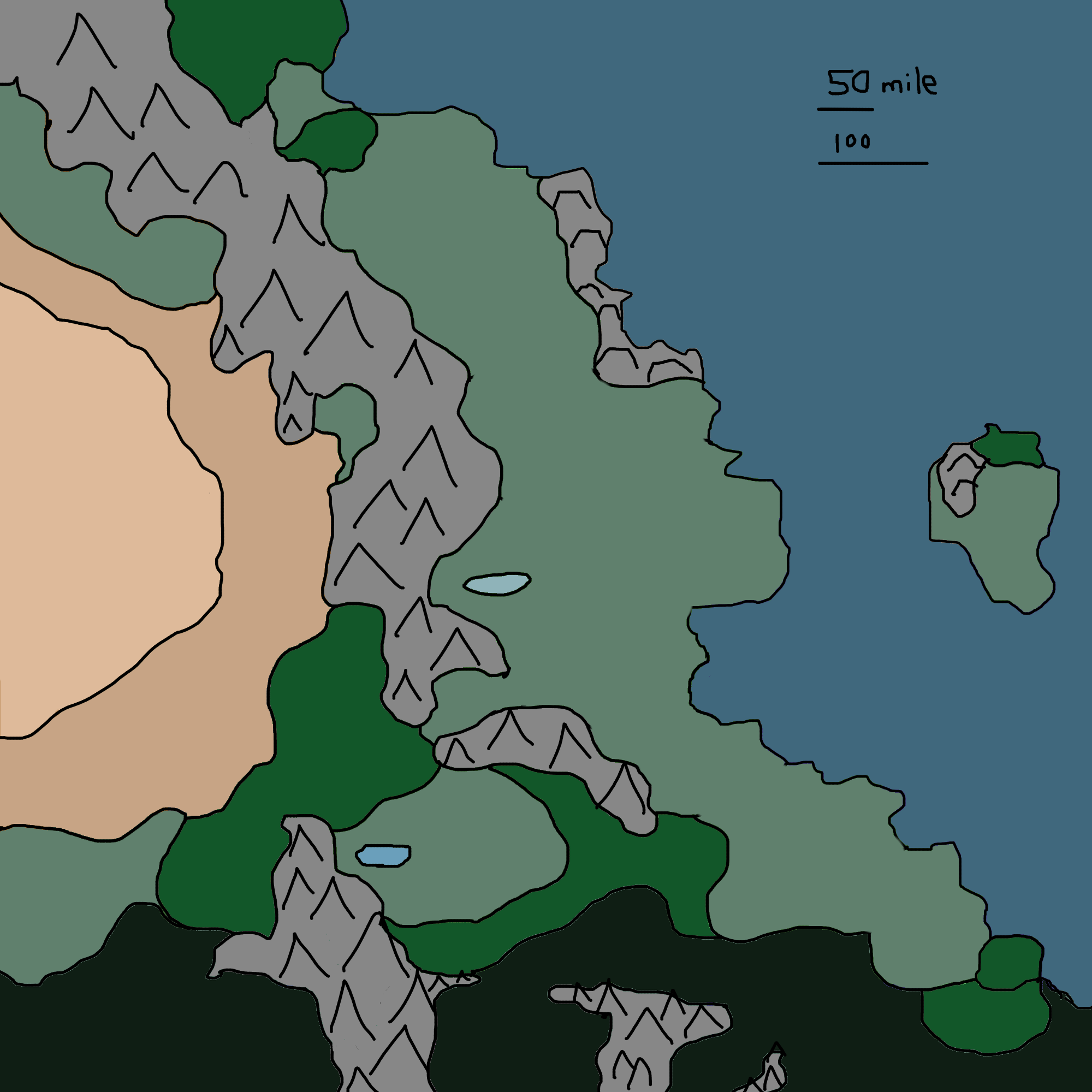
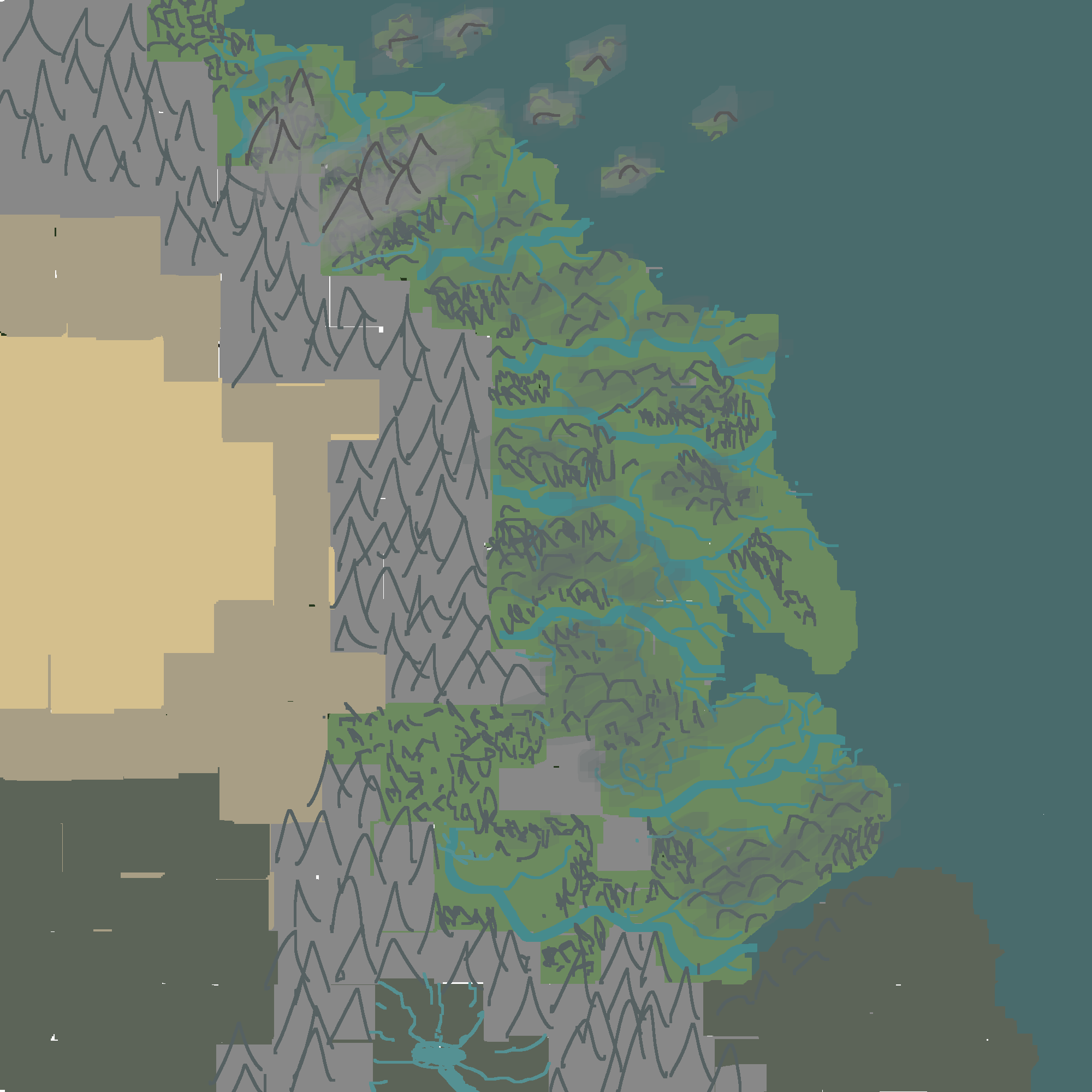
Map is 1000 miles long and wide. In general, do these placements make sense? If there were volcanos, where would they be, which side of the range? Is there a reason why the coastal area is be full of rivers and life, while the over the mountains it is dry and hot? Why would there be rocky islands to the north, on/off the coast? Are there logical places for forests? Can a desert like this make sense? Are there any benefits to knowing where the equator is?
This is a zone of safety for people, a haven protecting them from West & South. Perhaps 1-2 million people living here split between a few ruling faculties.

 (Tan/brown): Desert, dry land, hot.
(Light-green): Arable.
(Green): Dense forests.
(Dark-green/dark-brown): Cursed land, unnatural jungle, might be spreading.
