4
$\begingroup$

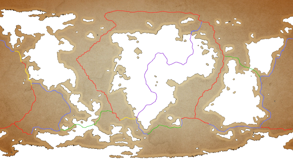
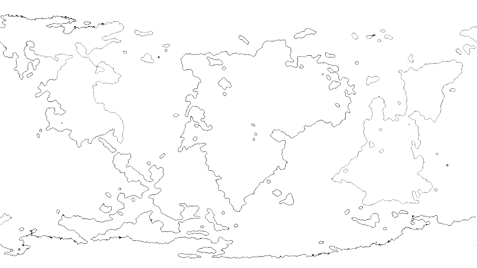
This is my map:
1

It was generated using tectonics.js, and I traced it in GIMP. For a while now, I've been having trouble pinning down just where exactly my tectonic plates should be. I tried sketching out some feasible plates using Earth's tectonic plates as a reference, but nothing really feels like it ..works.

This was my best attempt to date, but it was also my fourth try:

Now, I have looked at this question, but I'm not quite ready to throw in the towel just yet. There has to be some feasible way to add tectonics to a "dead" planet... right?

Please, someone give me some ideas. I'd really rather not have to start from scratch.

$\endgroup$
2
  • 1
    $\begingroup$ What does each color mean? no matter what it is the purple line through your center continent makes no sense. plate boundaries fall along continental margins unless they are a divergent boundary or an ocean to ocean subduction zone. since none of your coastlines match opposing continents this will be bit difficult. You may also notice subduction zones on earth are gentle curves, uneven coastlines don't survive subduction. generally you should think about plate tectonics while making a map not afterwards. $\endgroup$
    – John
    Commented May 28, 2023 at 22:02
  • $\begingroup$ I used this as a guide: en.wikipedia.org/wiki/Plate_tectonics And the way I designed my world was story-first. I hadn't even considered the official map until I created some settings that should fit in one. But I don't have any experience with mapmaking, so I used a program to generate a map for me $\endgroup$
    – Aisede
    Commented May 28, 2023 at 22:56

2 Answers 2

4
$\begingroup$

Most oceans are on a tectonic plate. They are also the largest. I would recommend finding the coasts that look like they could find into a different coast on an adjacent continent. Also, you probably know this, but plates should never meet at a “t”. A “t” is a four-way meeting of tectonic plates.

I would look at everything with a grain of salt because I am not a geologist and only know what I know from Artifexian and the Worldbuilding Pasta paper about mountains and other geological features.

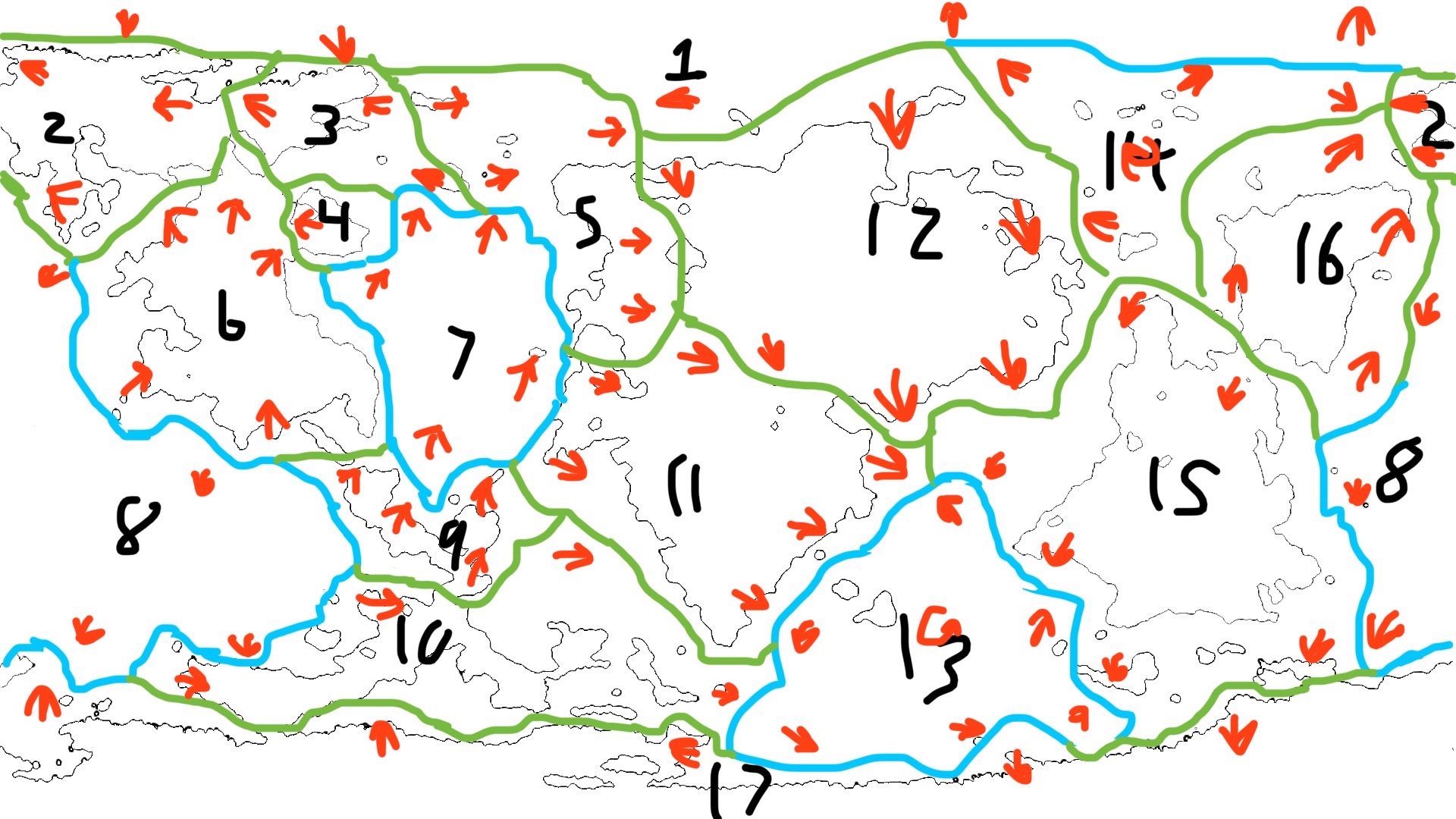
I suggest something like this.

enter image description here

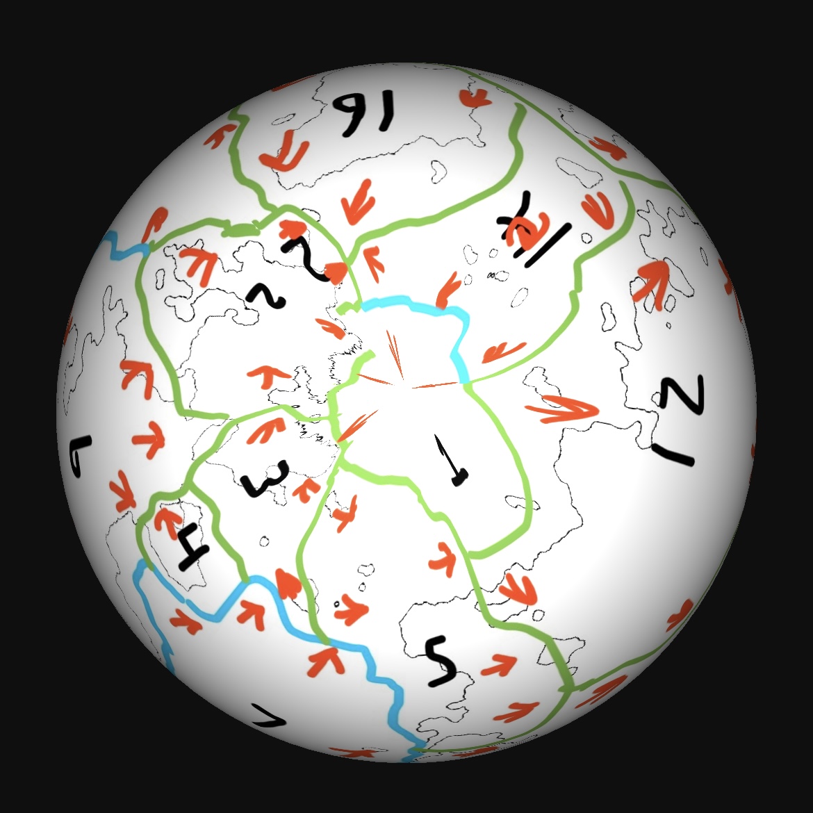
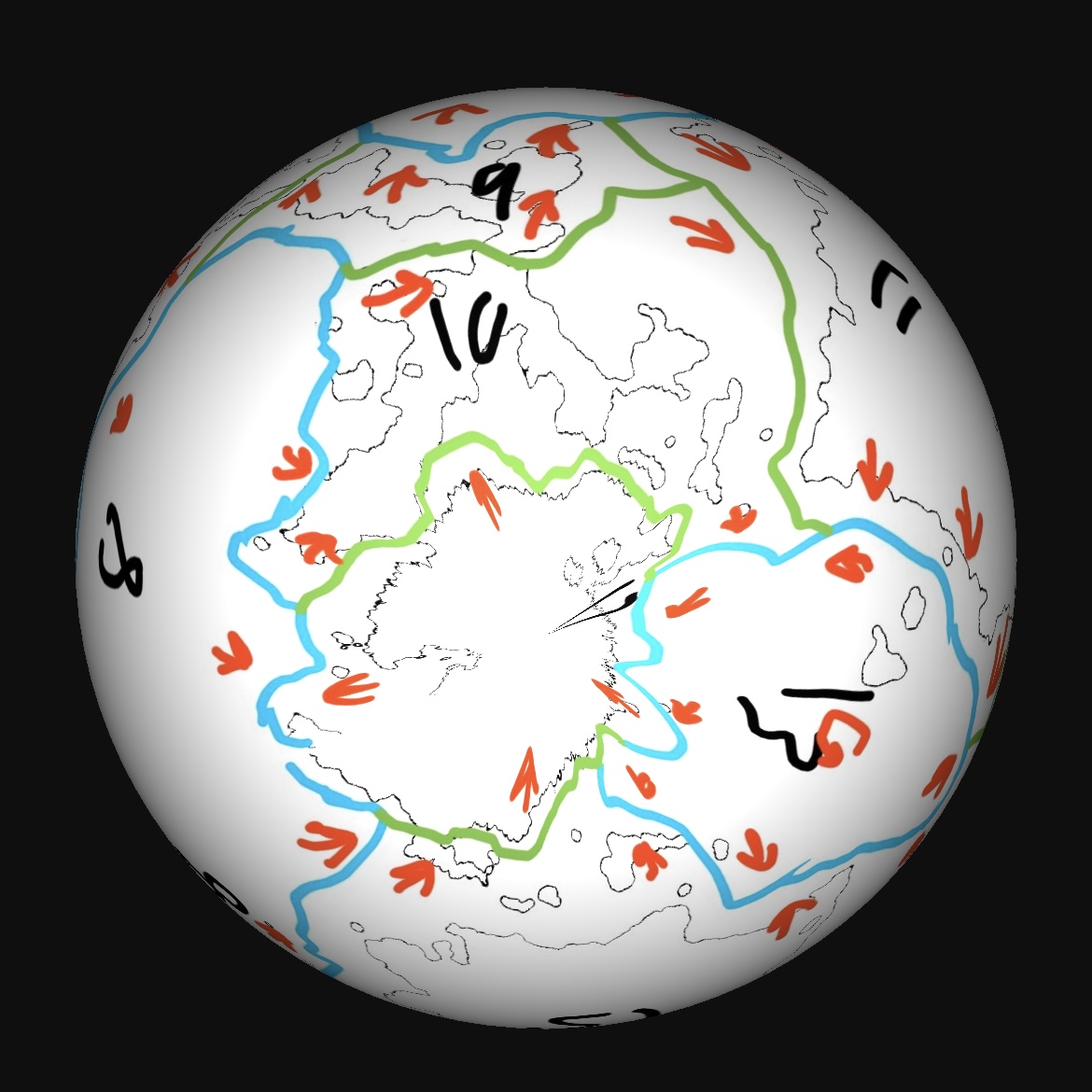
The poles look a little wonky but that is because drawing lines with my fingers is hard.

enter image description here enter image description here

$\endgroup$
3
  • $\begingroup$ Interesting... Which of these are divergent and which are convergent, though? I think I could work with this if I understand better what I'm looking at $\endgroup$
    – Aisede
    Commented May 29, 2023 at 4:33
  • $\begingroup$ Your claim isn't quite true. A tectonic plate has a high point (land) and a low point (ocean). There's only a small handful of plates (the massive Pacific Plate, notably) that are mostly ocean, none that substantially cross landmass and only one that nicks landmass. The problem is that the OP used tectonics.js (which creates "defensible maps") but didn't bring the explanation from the generator with him. We're second-guessing the code. $\endgroup$
    – JBH
    Commented May 29, 2023 at 14:24
  • $\begingroup$ @Aisede I have updated my answer to include all of the questions. $\endgroup$
    – Martamo
    Commented May 29, 2023 at 23:32
1
$\begingroup$

You're asking us to second-guess tectonics.js

I have no reason to believe tectonics.js doesn't do a good job, but it appears that it doesn't bother drawing the plate lines for you. That means you're asking us to second-guess what tectonics.js did... assuming it did it correctly and without too many assumptions.

There is a trend in worldbuilding right now to create the most "scientifically plausible world" possible. It's laudable. It's also a bit silly. Worldbuilding is so much more than "scientific reality." In fact, good worldbuilding is knowing when you need to focus on details... and when you shouldn't. Unless your story uses plate tectonics as a specific plot device, you're straining at the proverbial gnat.

Nevertheless, there are some >>basic<< rules that can help you

  1. Always start with a chart of Earth's plates.

  2. Plates always have low spots (oceans) and high spots (land.)

  3. Plates move and rotate. When they move away from one another, they create chasms (e.g., the Mariana Trench). When they collide they create mountains (e.g., the Himalayan Mountains).

  4. Volcanoes frequently happen along plate boundaries (e.g., islands and mountains). This is especially true when the plate is rotating rather than moving.

  5. Plates rarely cross landmasses. It isn't that they can't, it's that water erosion usually eats away at the sides of the land masses, leaving seas between the two land masses with a plate division along the sea. Thus, a plate bisecting a continent (incredibly rare) would have been two plates pushing together for a very long time, resulting in a substantial mountain range bisecting the continent.

  6. Though hard to imagine, it is believed the U.S. Rocky Mountains (forming the U.S. Continental Divide) were caused by the shockwaves of two plates colliding. In other words, mountains don't form only because of two plates pushing against one another. Mountains (or, generically, "high spots") also form due to meteor strikes or, perceptually, from water erosion (e.g., draining Lake Bonneville) or wind erosion (U.S. southwestern bluffs) due to low-density rock being blown away from high-density rock. You can also have sink holes due to the type of rock (e.g., limestone). In short, you need to realize that you'll have high spots (mountains) and low spots (lakes...) in locations other than plate boundaries.

Using these rules, you can start with some basic assumptions:

a. Your average plate will have ocean encompassing a landmass.

b. In the majority of cases, touching landmasses will touch lightly or with small stretches of land (e.g., an isthmus). Note that an isthmus can form due to soil buildup around the two plate boundaries having little or nothing to do with the plate boundaries. I.E., ocean currents deposit sediment that reinforces the currents' behavior until an isthmus forms.

Your map is actually very hard to work with, and it's the fault of the assumptions made by tectonics.js

  • Where are the polar caps? Polar caps help identify how much water is available. In a warm year there's less cap and more water, meaning greater separation between land masses. In a cold year there's more cap, less water, and more connectivity between the land masses.

  • The outline map really is only showing us coast lines. It doesn't show us topography, which is really what we need to identify plates.

  • How much water is on the planet? If we knew the topography, then the amount of water would dictate land mass connectivity save for where two plates have been colliding for a very long time.

In the end, sketch some quick boundaries based on the map of Earth's plates and the rules I've given you... and move on.

As I said, unless tectonic geology is a critical plot point or plot device in your story, you're straining at a highly technical bit of science that humans don't yet completely understand in the first place, all for (what I suspect is) a goal of dubious value. If your goal is a map, it would be easier to sketch in mountains, lakes, cliffs, and rivers where you need them based on narrative necessity and move on.

$\endgroup$
8
  • $\begingroup$ Could you give an example of a bisecting plate. Are you referencing the Indian, Arabian, and Caribbean plates? $\endgroup$
    – Martamo
    Commented May 30, 2023 at 3:30
  • $\begingroup$ @Martamo "Bisecting a continent." There are no examples on Earth of a tectonic plate bisecting a continent. If we follow Rule #1 and examine a map of Earth's tectonic plates, we can see that the Antarctic Plate contains a chunk of landmass connected to the Eurasian Plate, but it's not bisecting the Europe/Asia/Middle-East land mass. Rule #5 basically says, "don't bisect continents with tectonic plates." $\endgroup$
    – JBH
    Commented May 30, 2023 at 16:19
  • $\begingroup$ I am confused then. What does bisecting mean? Do you mean like three plates under one continent? $\endgroup$
    – Martamo
    Commented May 30, 2023 at 18:02
  • $\begingroup$ @Martamo Bisecting means "in the middle of" or "split in two." In this case, it's describing going substantially though the center of a continent (very large land mass). The larger the two halves, the less likely there are more than one plate involved. 99.9% of the time, a tectonic plate is one or more islands (some as large as continents) surrounded with water. When two plates come together, this will commonly create a sea between the two (possibly loosely connected) land masses. For that sea to disappear would mean (*Continued*) $\endgroup$
    – JBH
    Commented May 30, 2023 at 18:57
  • $\begingroup$ @Martamo ... the two plates had been pushing together for a very, very, very long time, creating a very large mountain range. There is no example of this having happened on Earth today. The closest example is that small piece of the Europe/Asian/Middle-Eastern land mass to the northeast, which isn't bisecting (implying to more-or-less equal halves). It's not just the largest example, it's the only significant example. If I recall, your map had 5-7 of those connections. That's unrealistic. $\endgroup$
    – JBH
    Commented May 30, 2023 at 18:59

You must log in to answer this question.

Not the answer you're looking for? Browse other questions tagged .