The short answer : yes, to an extent, depending on the unique circumstances of your continent.
I know that doesnt really answer much, so;
The Long answer
I am going to be assuming earth like conditions for your continent (4 seasons, 21 degree tilt, 365 day years, etc)
Vegetation levels depend on environmental water levels and availability, as well as nutrient availability and soil composition, as well as surrounding vegetation levels.
When talking about water levels, I am not referring to only the level of the water table, but to ground water, air humidity, and by extension rainfall amounts.
Airmasses are complicated
Rainfall is mostly based on humidity levels and water vapor content, with a bit of geological circumstances.
The amount of water vapor that air can hold (100% humidity), depends on the temperature of airmass, and that is determined by where the airmass originates.
We get 4 main types of airmasses, Polar continental, Polar maritime, tropical continental and tropical maritime.
Breaking this down, Polar airmasses are very cold, and therefore cannot carry much water vapor, so you are unlikely to get a lot of rain from them. You can see the effects of this with places that are near the south pole (Argentina, South Africa, Australia) and the North Pole (Northern parts of Canada and Russia).
Tropical airmasses however, are warm and can carry a higher amount of water vapor. When rain falls from these airmasses, you can expect a lot more rainfall (such as the gulf of Mexico, Gulf of Guinea and the Bay of Bengal)
The continental Airmasses generally do not have a high amount of water vapor to start with, do to forming over land, while maritime airmasses start at almost 100% humidity levels.
So, depending on where your continent is placed, the base vegetation levels will change. Near the poles, like Australia, you will generally be starting with a desert. between the tropics and the equator, chances are you will have a lot of vegetation even without a central lake.
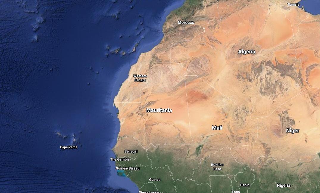
Looking at a map though, and you will see there are some places that do not conform to this, like New Zealand, Chile, Mexico, most of the Middle East and Northern Africa, areas of Spain, etc.
Why?
BECAUSE AIRMASSES ARE COMPLICATED
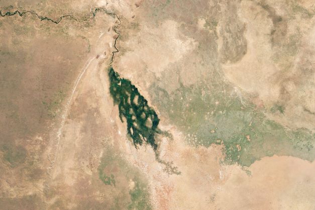
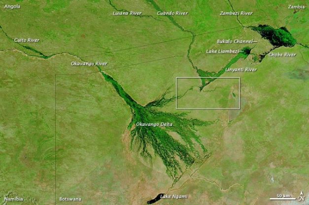
It is not enough to just have a high humidity content, you need to get the water out of the air. For permanent vegetation, you need a permanent solution, so you can rely on the hope that it randomly rains. Take for instance the Okovango Delta in Botswana, the dry season vs the wet season.
You need a permanent, geological feature, such as a mountain range, which provides an uplifting force to the airmass. As the air rises, its temperature drops, and the amount of water it can hold decreases, which results in rain.
Wind Direction and Lifting Force
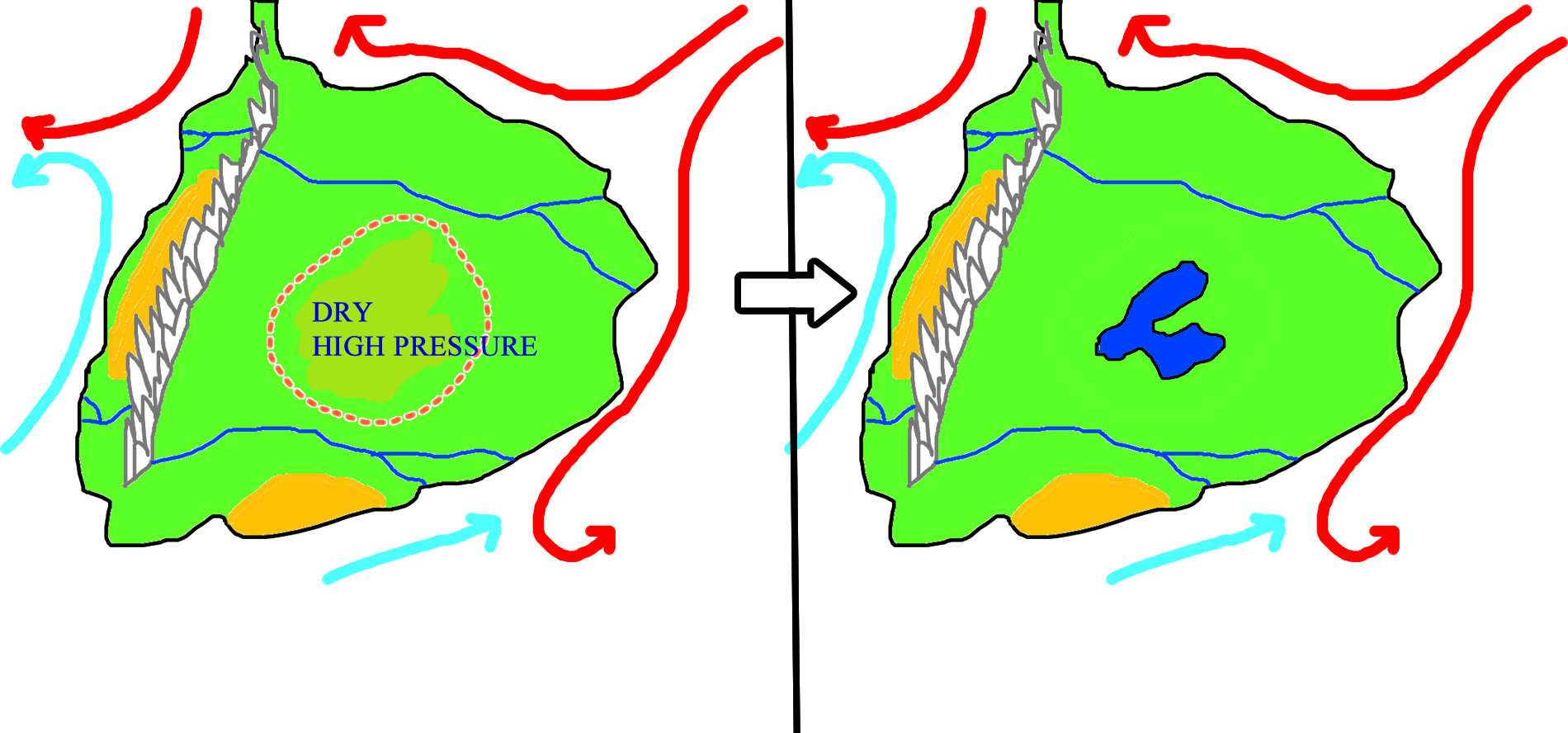
As shown with the answer by L.Dutch you can have an ocean of water right next to a desert, if the wind directions are not favorable. For Western Africa, the wind is generally coming from the north east, which is straight out of the center of the continent, blowing the warm moist air back out to the ocean.
From your image, I can see that there is a mountain range on the West coast, which would provide that lifting force. I am going to compare it to Northern South America, as it is quite similar.
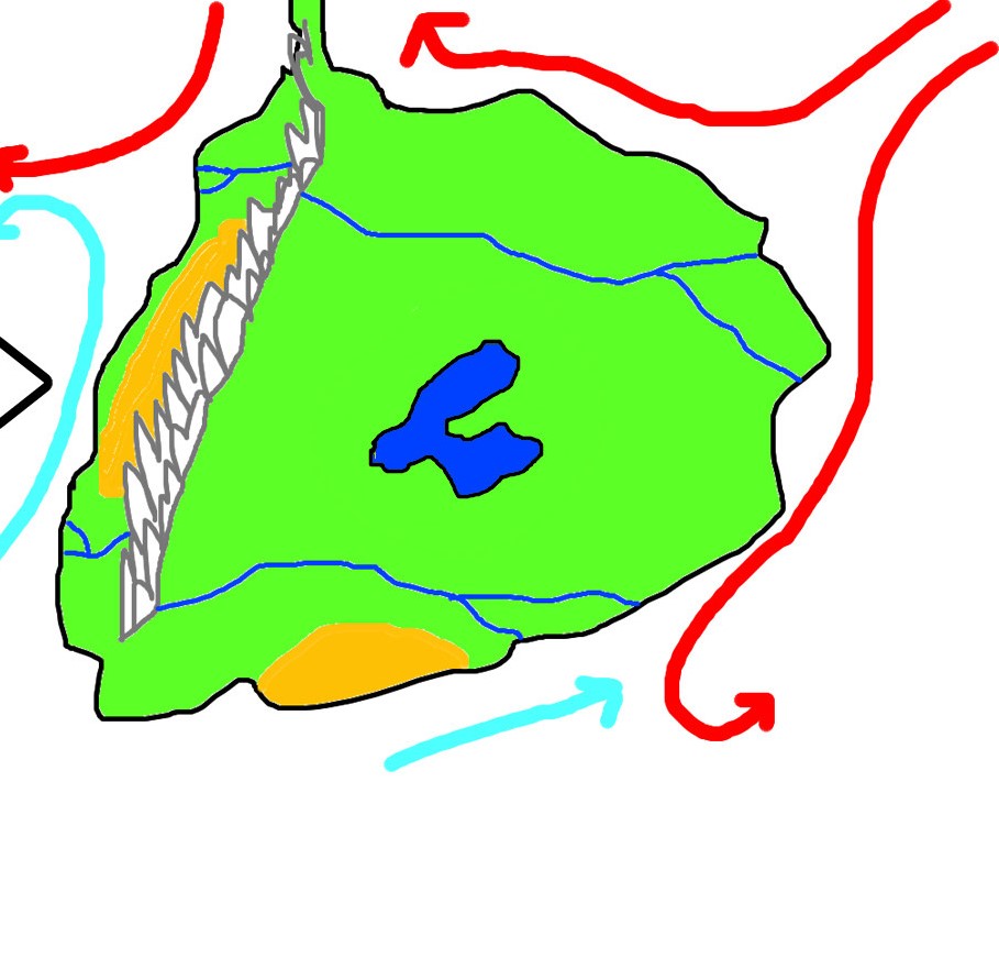
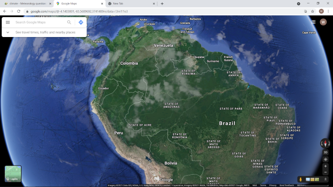
If your airmass is coming from the West, it is going to get caught in the mountain range, and only the Western coast would get any rain, with the central continent acting as a desert. If however your winds come from the east, baring a bit of random rain over the central parts, will rain on the mountains, and the water will flow into rivers, which you can take back to the east coast, providing lots of ground water.
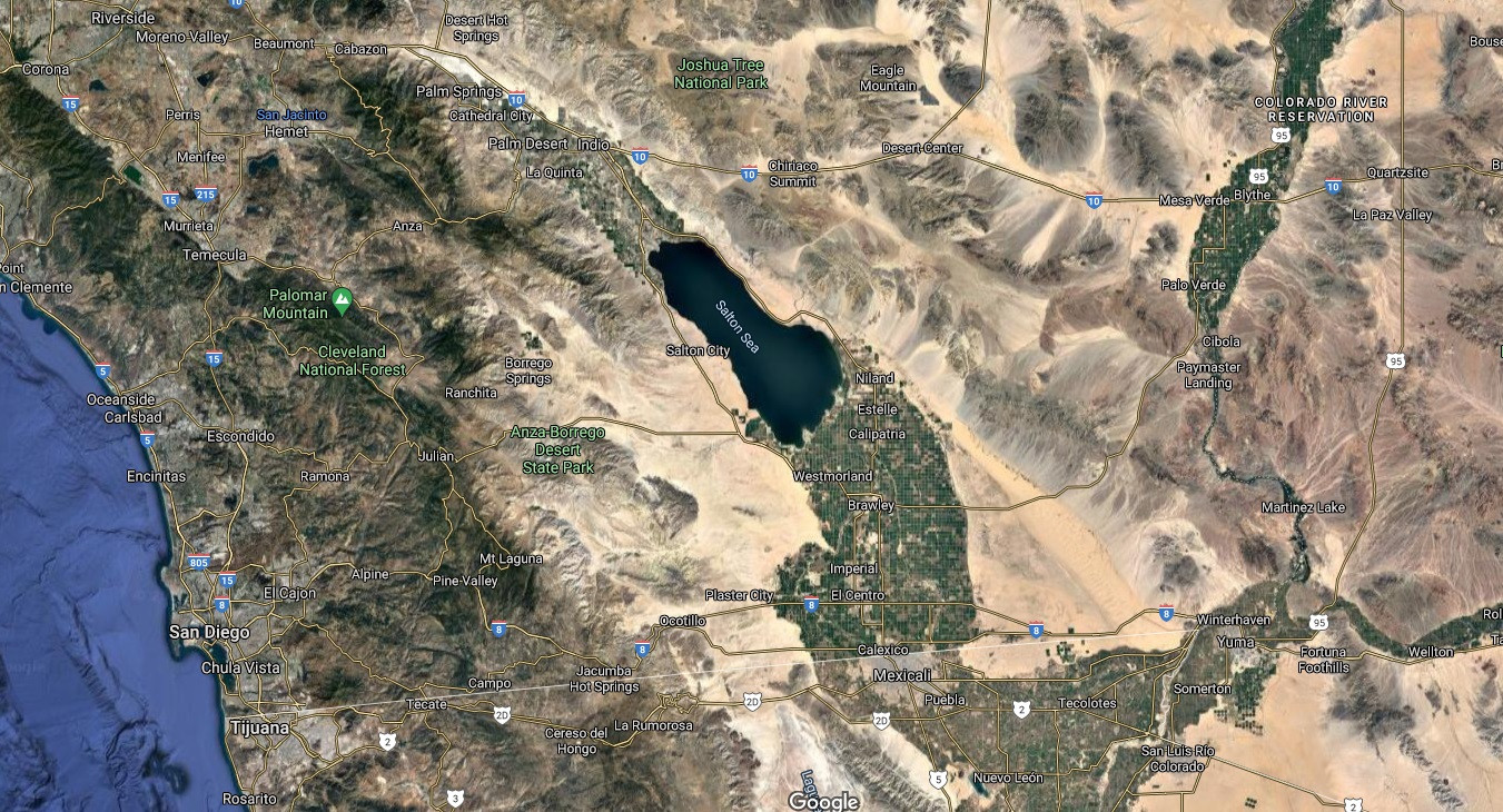
As to the existence of a central lake, unless your continent is very small, it would have a negligible effect on its own.
Two examples are Lake Chad and even the Caspian Sea
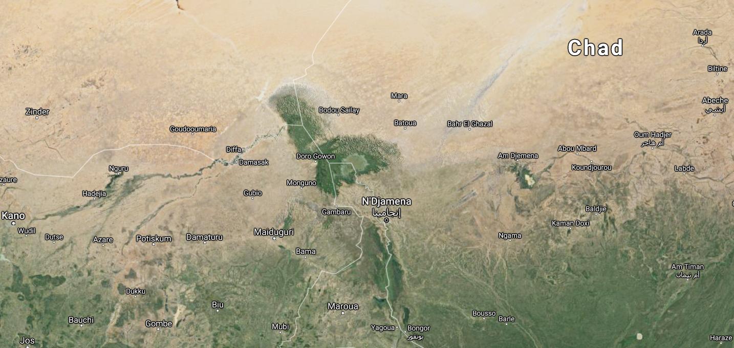
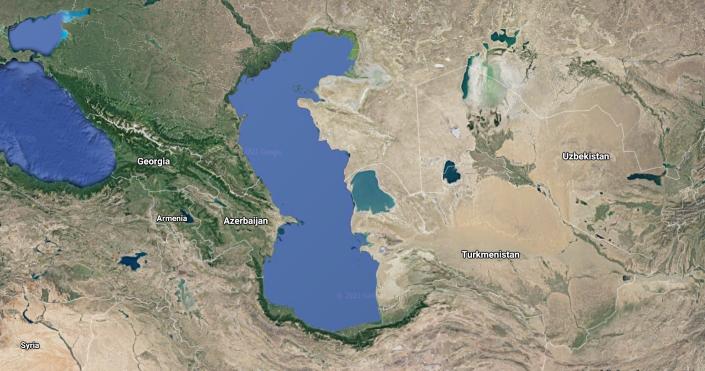
In both of these, you can see that other than a small area around the lake (or sea) there is pretty much still desert. While lake Chad is still quite small, only about 35km across, the Caspian sea is over 1000km length-ways, and about 300km wide, yet still does not help much.
But wait, you might say, in America, the area around Lake Michigan (+ the other 3 lakes) is extremely vegetated, and I agree, as we now come to the last bit of my answer.
Surrounding Vegetation and Soil nutrients and makeup
This might seem counter productive, but the reason that my example lakes do not result in much vegetation around them is because they are located in desert areas. With no vegetation to hold the water and prevent drainage, any rainwater disappears very quickly. For instance, in Western Africa, it is currently still the wet season. For the past two months there has been almost daily rain, with at least 5 to 10 times having most of the area flooded by about a foot of water, since June. unfortunately, it drains quickly into the few rivers, and washes out to the ocean without being sucked up by any plants. As it does this, it washes away any topsoil, which is basically organic matter made up of dead plant pieces, bacteria and a bit of loose ground. Growing plants need that topsoil to grow, so having it removed prevents plants from growing. Less plants growing results in more topsoil being exposed to being washed away, and the cycle intensifies. Plants also need to come from somewhere, like a tree dropping some seeds. If there are no nearby plants to spread, they simply can't.
So in conclusion, Yes a central lake can help create a lush interior of the continent, but there are other factors that play a much larger part in determining whether you have an oasis of life, or a desert of death.

